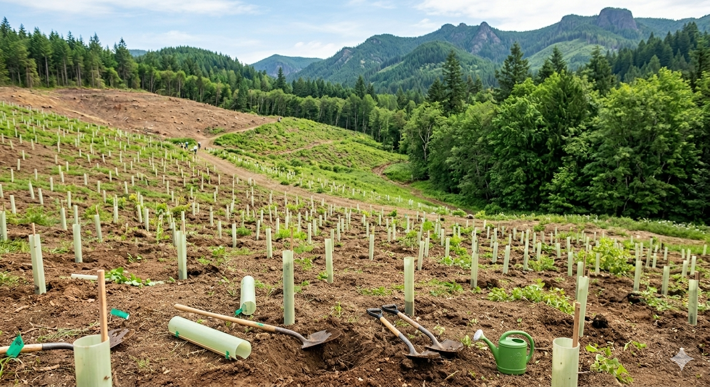
We rise with purpose, act with unwavering integrity, and stay curious as the land comes back to life.
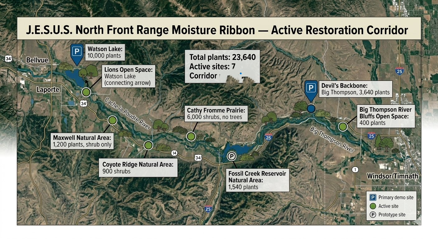
"Operating across pre-approved public open spaces in the North Front Range region, the initiative coordinates the phased planting of native trees and shrubs. Our projects utilize standard, low-impact landscaping methods to support local habitat conservation and routine environmental data collection under strict safety guidelines."
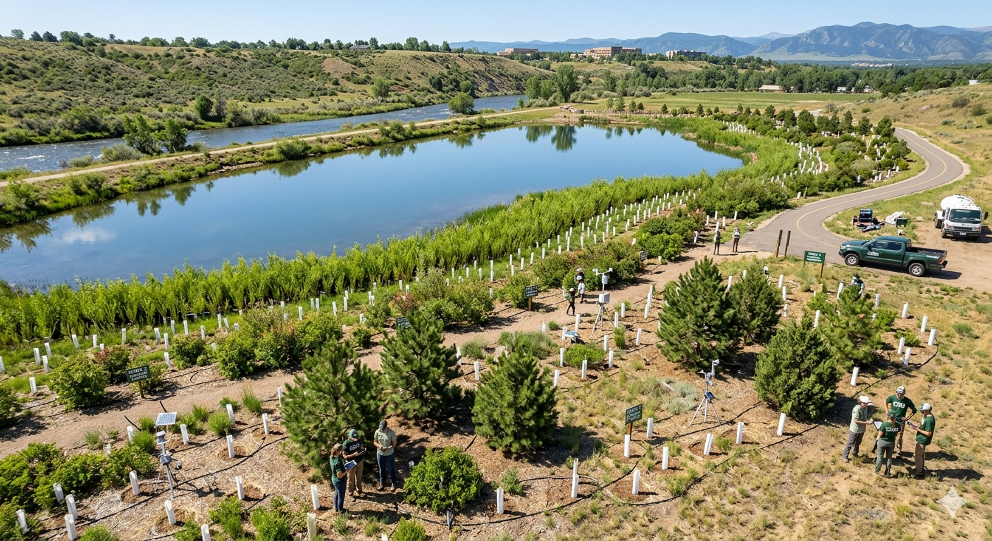
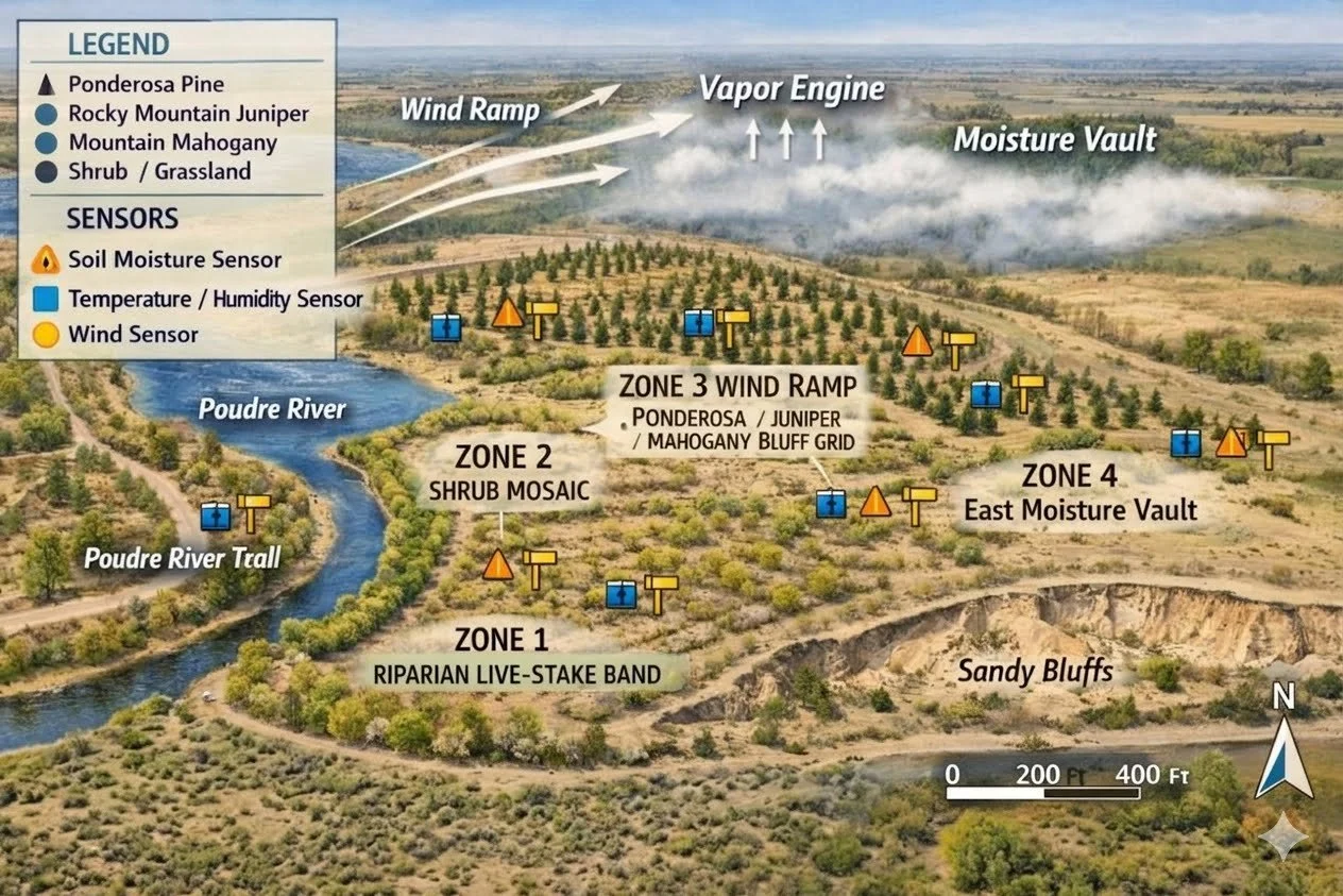
This is not a tree planting program. It is a precision restoration operation: every site instrumented, every claim measured against an unplanted control zone, backed by military-grade logistics and active irrigation through the critical establishment years.
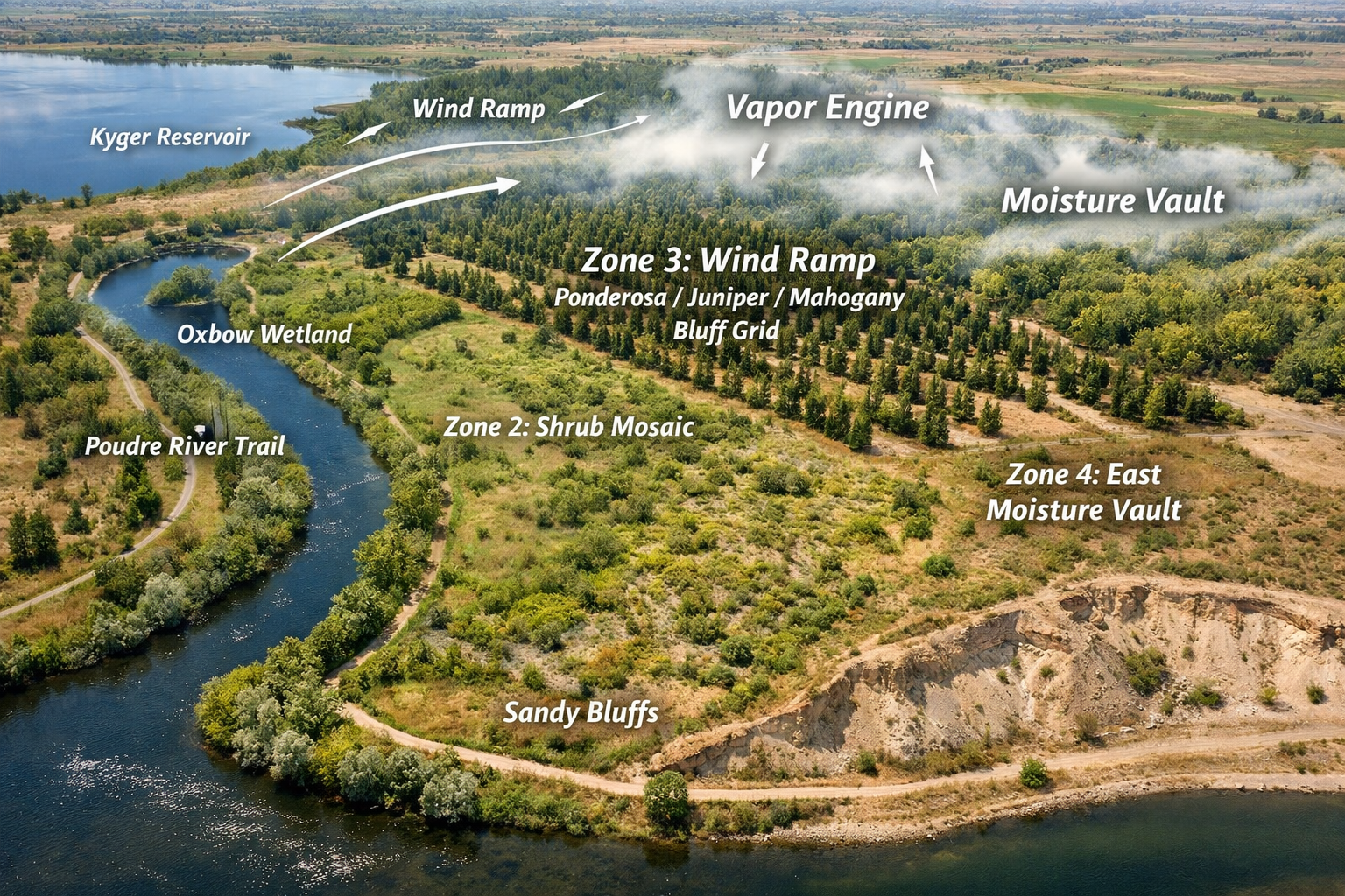
The question we are built to answer is whether restoration can measurably reduce Vapor Pressure Deficit — the atmospheric drying pressure that pulls moisture from soil, plants, and rainfall itself across the Front Range. We instrument the ground to find out honestly, including the possibility that the effect is smaller than we hope.
We are building partnerships with land managers, academic institutions, and regional communities dedicated to impactful ecological work. Our aim is to unite local authorities, scientists, and volunteers in precision restoration that produces lasting watershed resilience — and the data to prove it.
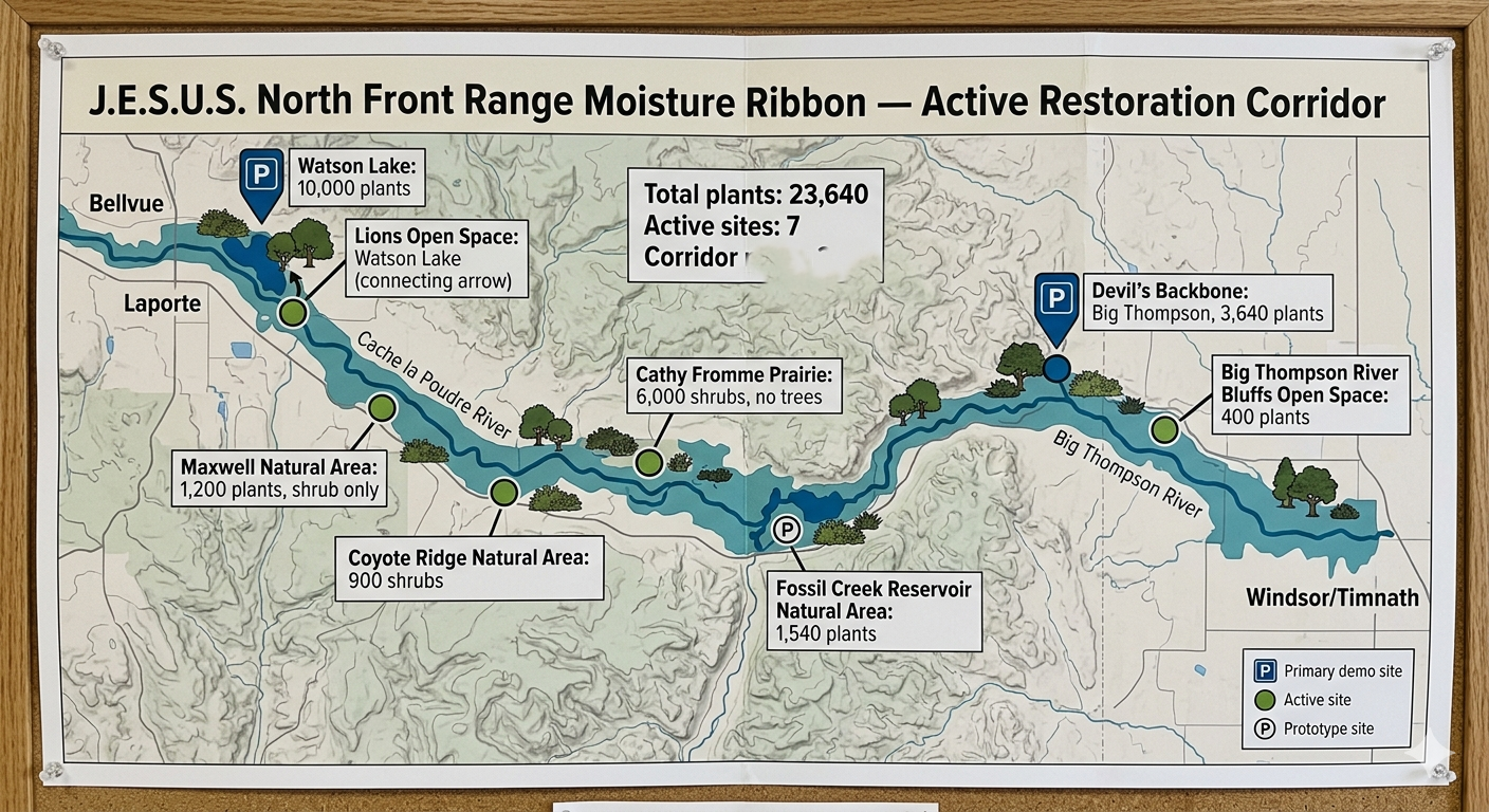
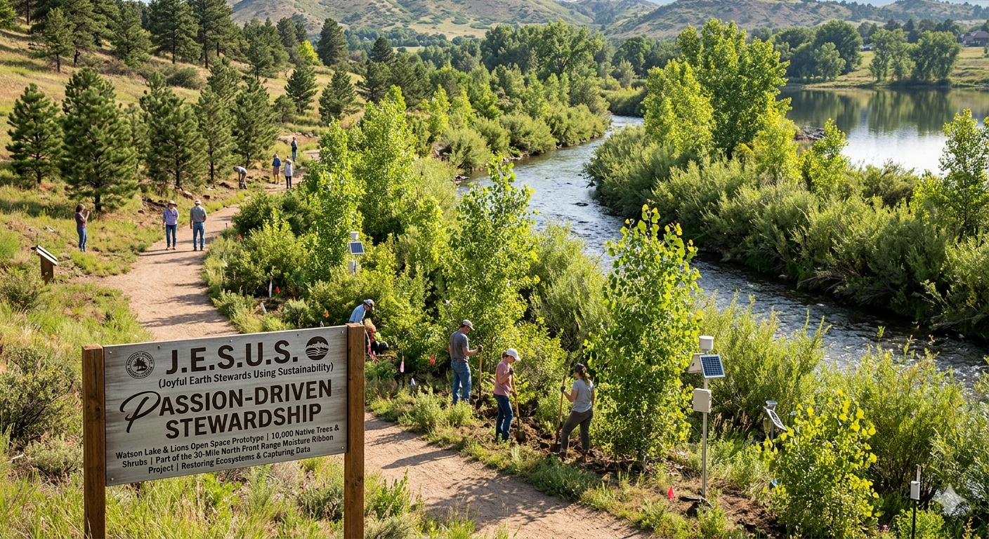
Driven by the power of native trees to heal rivers, renew ecosystems, and change the future.
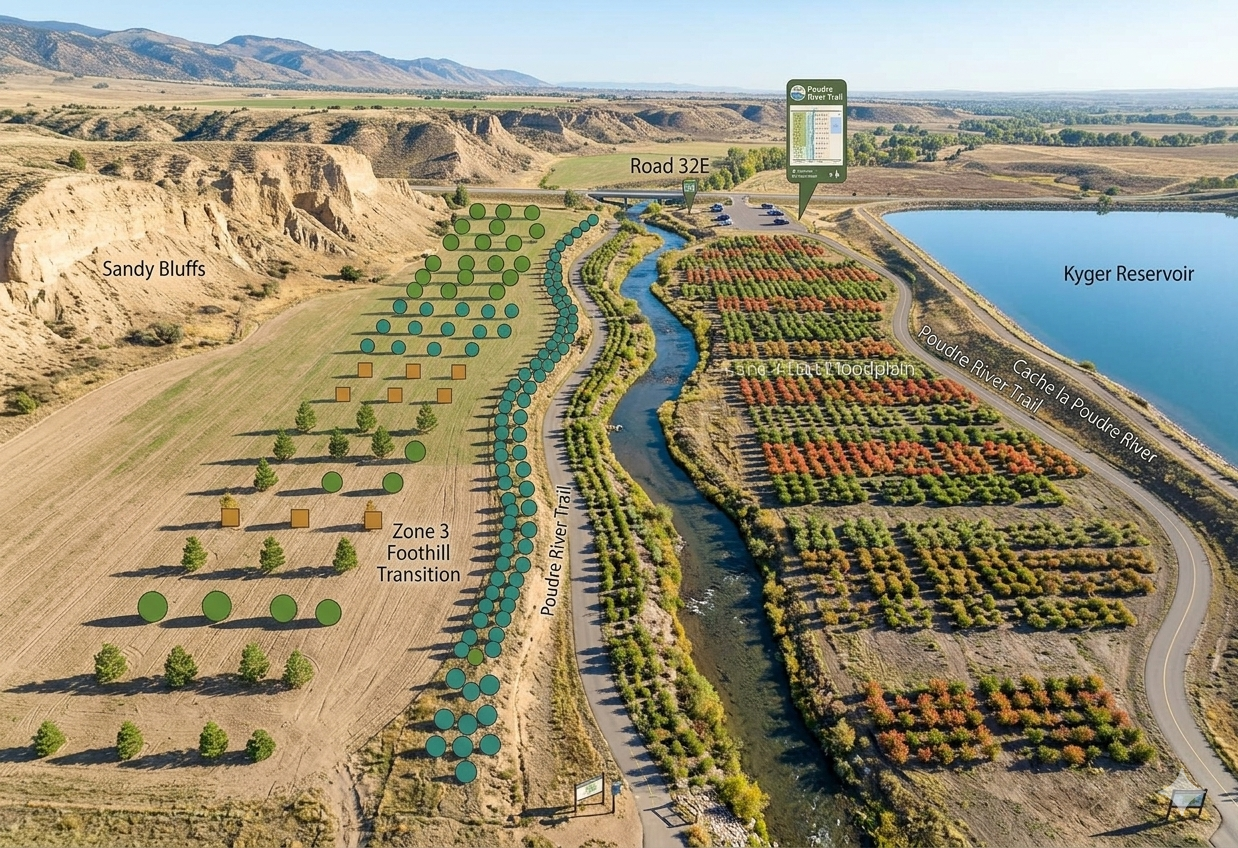
"Joyful Earth Stewards Using Sustainability (J.E.S.U.S.) has developed a managed 9-acre native planting campaign across designated project sites. Serving as an initial demonstration plot for our local environmental programs, these sites feature a diverse selection of 10,000 native trees and shrubs—including cottonwood, willow, and pine—to support local vegetation health and facilitate routine visual site monitoring."
Where Science Meets Stewardship: Calibrating Our Ecological Future
We propose establishing a fully instrumented, 9-acre calibration site to demonstrate our precision restoration methods along the riparian margins of the Cache la Poudre River. The tentative plan involves planting a dense palette of 10,000 native species, including fast-transpiring Fremont Cottonwoods and deeply rooted Coyote Willows, to test advanced riverbank stabilization and erosion mitigation techniques. This proposed footprint is designed to act as a scientific model, capturing real-time transpiration and soil moisture data to develop scalable solutions for the regional Front Range water security crisis. Ultimately, the prototype aims to prove that these targeted ecological interventions can lower local vapor pressure deficits and drop stream temperatures, creating a climate-resilient buffer that secures long-term water resources.